NEORA VALLEY FOREST – A BRIEF DATA
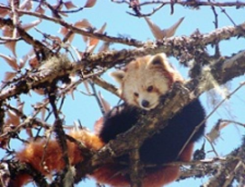
As we all know that a small part of Himalaya comes under the West Bengal Belt and most of that is at the Dooars part, the lower Himalayan range. For that reason a large part is not visible from here. But wide varieties of tropical forest (where rainfall is very frequent), waterfalls, small and large streams, rivers along forests and jungles are seen here. In the year 1992 stretches of Neora Valley terrain and its surrounding forest awarded its title of a National Park. Neora Valley National Park is about an area of 88 sq kilometer. It is situated between 26 degree 52’3″ and 27 degree 7’35” North latitude and 80 degree 45′ to 80 degree 55′ East longitude. And it this National Park just at foothills of Himalaya and in the heart of Dooars area is home to many wide varieties of flora and fauna. The bamboo village in this region is home to one of the rarest species of animal the “Red Panda”. Apart from Red Panda, here resides other variety of fauna like Clouded Leopard, Leopard, leopard cat, Himalayan black bear, barking deer, Himalayan Thar, goral, gaur (Indian Bison) and the flying squirrel.
Not only those, but also in the recent study show traces and pugmarks of Tiger are seen rarely that migrate from the Bhutan Hills. Wide varieties of flora are also present in this forest, from organic herbs to age old trees; some of them are very hard to identify with names and usefulness, also many species of Orchids. This is National Park so old that till date there are many regions of the park are restricted for entry of local people and tourists. Forest Department has restricted some part of the park where entries for tourists are open but that is also by trekking. But if you can overcome this trekking route you will get a different taste of jungle trek. But it is recommended to take a guide.
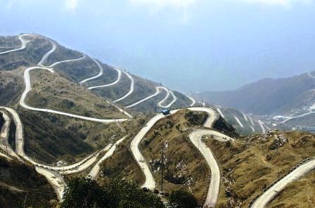
Once you leave the area of Lava you will get to see the jungle starts where varieties of trees and jungle herbs are seen. Though from Lava to the entry in the park the road is full of boulder, it will be very clear that car here hardly enters. The road is covered with lush green bush that has grown with time and rainfall. Once you will enter the area you will get to see hedge hogs and barking deer in around. After few distance you will get a glimpse of Mt. Kanchenjunga, but that is also for few moments after that it will again disappear in the trees and hills. After few hours journey you will reach at “Chouddaferi”. From there you need to get the entry at the National Park from Forest Department’s check post and there is a forest rest house. From its balcony, lawn and rooms Kanchenjunga is clearly visible. Within the boundaries of mountains, hills and jungles “Chouddoferi” is an awesome attraction. From Chouddoferi, again you need to start your trek towards “Zero Point”. But if you spend one night at Chouddoferi, then it will less hectic. From Zero Point trekking starts. Sometimes uphill and sometimes downhill trek. Both sides of the route there are numerous trees and herbs along with age old trees with planktons grown all over. Here Sunlight hardly enters. The whole area is swampy wetlands. And there is pin drop silence all around except sounds few insects. Here are there are “Pug-mark Identification Point” of wild animals which also signifies presence of wild animals.
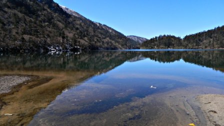
After sometimes walking along the jungle trekking route you will reach to river (though small hilly stream is more appropriate). The locals say that the name of the forest comes from this small stream. Though there is no similarity between the streams of Gorumara national Park, but still in the hilly terrains within the forest this small stream will surely attracts you. On the banks of the steam there is a bungalow, with “Bamboo Cottages” maintained by the “People’s Health welfare Society” which is worth watching. One night stay in this bungalow can be an excellent experience. On reaching near the stream you will get to see that large pipelines are made through which water is distributed at Kalimpong. In the eighties there was big chaos took place regarding this project for disturbing the balance of Nature. While you walk by the stream sometimes on the right hand side and sometimes on the left hand side at last you will reach to the “Jaributi” watch tower. Maintained by “Save the Wild Life Project”. From the watch the view of the while forest along with the hills is outstanding. Here in this forest goes on the rumbling sound of the river and with the silent air coming from a long distance. From there you need to come down towards “Aluabari Camp”, from there the trek to the uphill by the narrow route. In comparison to “Chouddoferi” or the “Bamboo Cottage” this camp is to a large extent like a farm house with forest on all sides, which signifies that some time in the past human habitat existed here. But now after the place recognized as a national park, human settlement has been restricted. The area upto which tourist entry is permitted is the Upper Neora Valley by Chouddaferi – Aluabari- Bochila Dara – Tandong – Tode towards Jaldhaka. Another area is by the lower Neorra Valley via Samsing – Mouchaki Camp – Bhotkhakra. Though in the past when there was no permit required to enter the park it was very dangerous which is known from “Kishore Chodhury’s Neora Valley” expedition in the year 1982. The next part of the forest is denser, everywhere there are full of bamboo fields. Very rarely Red Panda can be seen in this area. This animal is not only rare species but also in the threat of serious extinction. This animal has a different habit, the whole day it sleeps and in the evening it huts for its food. While walking through a route on a side the road has straight down towards “Main Khakra”. While walking straight to the north the route has adjoined to the area where West Bengal has meet up with Sikkim and Bhutan Hills. At the end of the route you will reach at “Jorapukhuri” where you will get to see Rhododendron. Some say this area as “Sacred Grove”. This place is name Joraphukhuri after two different pokhri’s meeting point. From Aluabari to Rukacamp this is the only place where water is available. From there the route is towards straight north, here the road is a little downhill. While walking through the route there you will get to see numerous “Fern Trees” along with many colourful herbs. From there you will reach at “Ruka Camp” maintained by “Forest Development Corporation”. Locally called “Camp Orchid” name after the numerous Orchids in that area. It says Neora Valley National Park is home to many rare and extinct species of Orchids. But here you will be spellbound by species of birds. Some of them are rarely extinct species. Few of those which are often visible Mayna, Parrot, Barbet, Woodpecker, Babler, Fly Catcher, Finch, Thram. Sometimes you will get to see Owl, Kaliz, and Hornbill. But Rusty Bellied Storkwing, Wordstogon, Shatter Tragopan and Rukas Necked Hornbill, Sunbirds, Patridges. Back side of the forest the route has meet up plain land; from there the route has gone Dabakhola. From there it is clearly visible the Jhaldhaka River, from there while walking by a hanging bridge you will reach to Tode. There the forest route ends here.
Few Things to Know: From Siliguri direct bus to Lava are rarely available, it is better to avail the Kalimpong route. It is about 105 Km. and from Lava to Zero Point via Choddaferi it is about 12 to 14 km. You need to hire jeep. Entry and permit to the national park is available from “Forest Department’s” office. Best time to visit between October to April. Lava nature interpretation center remains closed on Thursday.
For any queries please call us at 9830381306 , 9830387637

Leave A Comment
You must be logged in to post a comment.